
Products & Equipment
Pits & Quarries
Five questions to ask before buying a drone for mapping
June 19, 2017 By Rosalie Bartlett/Kespry
June 19, 2017 – Buying a drone for a new mapping program at the enterprise level can be confusing. With all of the options available – consumer, prosumer, and commercial – figuring out what your business needs means asking the right questions. Here are five questions – and five important considerations – to help you evaluate drones for mapping.
#1. How easy is it to fly?
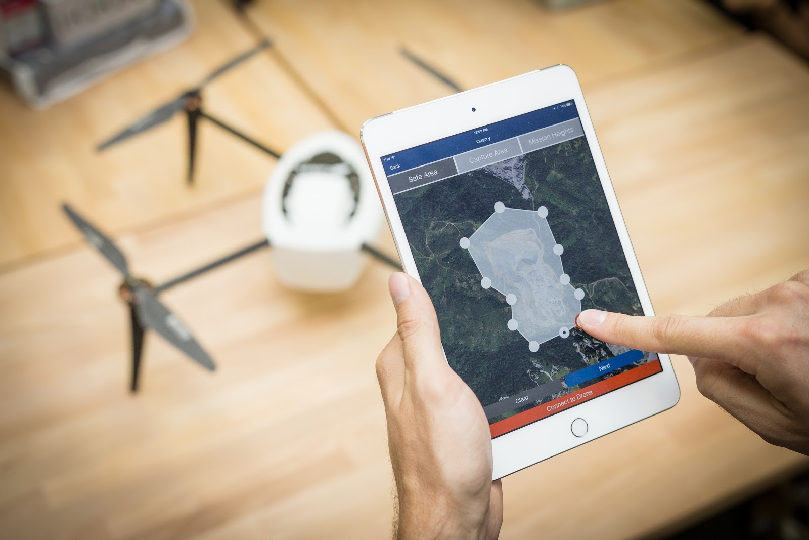
If your company is investing in a new drone program, one of the first things you’ll need to determine is who will be responsible for flying. If you don’t have a pilot already on your team and you don’t wish to hire new people from outside of your industry, ease of use will be an important feature to look for.
Consumer and prosumer drones can be difficult to fly and expensive to crash. Commercial drones with real automation features allow anyone to fly well, and even take care of the obstacle avoidance. Automated, professional drones like Kespry’s have no joysticks and require no piloting skills – you just plan your mission on an iPad and the Kespry drone calculates the flight path and flies.
#2. How Accurate is it?
Different types of drones provide different levels of accuracy. Make sure your purchase can provide the data you need by asking about the type of sensors available and the accuracy of the output. High-quality topographic maps suitable for design and other industrial purposes require a professional drone, one that carries professional grade cameras and can deliver repeatable survey grade accuracy.
Look for sophisticated systems that can be configured to maximize the quality of imagery for your job type. Specifically designed for industry, Kespry’s drone uses a Sony UMC-R10C camera and a large Exmor APS-C Sensor to capture the data needed to calculate volumes, measure distances and angles, and develop the highest quality topographic maps.
#3. How do I end up with actionable data?
The drone is only one part of an aerial intelligence platform: it captures the data, but you’ll need a platform to turn that data into actionable insights. A standalone drone purchase will require that data be uploaded to a separate system for processing. That transfer can require moving SD cards around and dealing with time-consuming uploads when you are working in remote areas, and can cost your company time, additional vendor fees, and risk.
Enterprise customers are gravitating towards single vendor solutions like Kespry, which provide tight integration between the pieces of the system. The Kespry system transfers data wirelessly, removing the need to deal with SD cards or other peripherals. It handles the data transfer from drone to analysis platform automatically for you – even in remote areas – and delivers high-resolution orthoimagery in the secure Kespry Cloud within minutes.
#4. What kind of customer support is available?
Support is an important component of any enterprise program, and drones are no different. Most consumer and prosumer drone companies are based overseas; few provide support or training programs appropriate for business. Support for your drone program may involve more than just hardware issues: you’ll need to work through regulations, flight planning tools, and figure out how to process the data once it’s captured.
An enterprise solution like Kespry’s end-to-end intelligence platform includes all of the support necessary to get your drone program off the ground and keep it there. You’ll get help with training pilots for Part 107 certifications, navigating regulations, and maintaining all of the elements of the system – from flight planning to deliverable. When choosing your drone mapping system, make sure you ask lots of questions about how the provider solves problems and complications, not just what the drone can do for you when it’s working as it should.
#5. What’s the ROI?
When purchasing a drone for commercial applications, the price of a drone is less significant than the return on your investment (ROI) and total cost of ownership (TCO). Enterprise customers look closely at staffing requirements, quality of deliverables, and risk factors. Flight planning, data processing, and delivery systems will also have to be supplied. Providing your company with accurate mapping can be a mission-critical task, so reliability and support are critical.
TCO is another significant consideration to bear in mind. The original purchase price of the drone can sometimes be kept low with ‘per flight’ costs designed to supplement that perceived saving. To get value out of your drone and data solution, you’ll likely want to fly regularly, so these per flight costs can add up quickly. You also need to take into account depreciation on the equipment if you’re buying it outright. Commercial technology advances quickly, so the shelf life of your drone could be as little as 18 months before you have to buy again.
Drone companies like Kespry with deep expertise in the enterprise can provide information about typical customer returns and help to address concerns about training, staffing, security and support throughout the workflow. They also operate on a subscription model that covers all aspects of the system, both software and hardware, so you have ‘future proofing’ and maintenance costs covered from day one.
There’s a lot of information available about drones for mapping: companies tout features, sensors, specs and uses. But at the enterprise level, the most important consideration often isn’t the drone – it’s the actionable data you get from the map and the reliability with which you can keep getting it on a daily basis. Asking the right questions can ensure that you’re getting a solution that can deliver.
Rosalie Bartlett is the marketing manager for Kespry.
Print this page