
Features
Roads & Paving
Technology
Manitoba launches online, interactive map for highway projects
July 19, 2021 By Rock to Road Staff
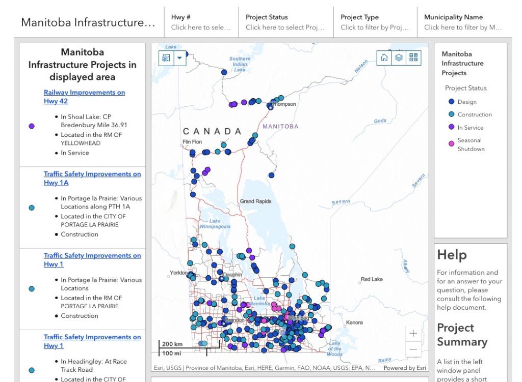 Screengrab from the website.
 The Manitoba government has created a new online interactive map that displays highway projects that are underway in communities across the province.
“Over the next 10 years, Manitoba will be recognized as a national transportation hub, linking east to west, north to south and enabling strong economic activity within and across our borders,” said Infrastructure Minister Ron Schuler.
“The work currently being undertaken will enhance transportation mobility and connectivity, ensure safety and reliability across the highway network, and enable industry expansion that leverages Manitoba’s diverse economy.
Searchable tool
The interactive map is a new searchable tool that displays highway expansion and infrastructure projects that are planned or underway in communities across the province.
The online tool also includes project pages that contain fields with information about the locations, project start and completion dates, and provides information to Manitobans and motorists on infrastructure in their home and destination areas. Users are still encouraged to use Manitoba 511 for up-to-date road information.
“In consultation with our organization, the Association of Manitoba (AMM) commends the provincial government for advancing technology which features up-to-date information on Manitoba infrastructure projects. This new interactive map is a positive step forward that will not only improve transportation mobility, but also boost economic linkages that will help build stronger local communities across Manitoba.” Kam Blight, president, AMM.
$1.5 billion investment in roads
Budget 2021 committed $1.5 billion over the next three years to invest in Manitoba highways, roads and structures this year. These include major investments related to the PTH 100 and 101 (the Perimeter Highway), and projects around the province including:
- paving eight kilometres of the Trans-Canada Highway on the eastbound and westbound lanes from PTH 26 to 0.8 km west of PR 334 (St. François Xavier to Headingley);
- paving 29 km of PTH 34 from the Trans-Canada Highway to PTH 16;
- paving 28 km of PTH 6 from Wabowden Access to Sasagiu Rapids; and
- a structure replacement on PTH 1A at the Portage la Prairie bypass 7.6 km east of PR 305 with a total project cost.
The new interactive online map can be found at www.gov.mb.ca/mit/mipmap/index.html.
Print this page