Features
Roads & Paving
Technology
The Benefits of New Technology
Dicrete gets results using GPS technology.
December 2, 2013 By Andrew Macklin
For 25 years, Dicrete’s curbing work for new housing developments was
labour intensive, and required personnel on each crew to string the
lines to ensure the concrete was laid accurately.
For 25 years, Dicrete’s curbing work for new housing developments was labour intensive, and required personnel on each crew to string the lines to ensure the concrete was laid accurately. That changed in 2013 with an investment in stringless curbing technology.
 |
|
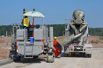
| Dicrete started using the GPS technology in 2013 at this 1,000-unit housing development north of Oakville, Ont.
|
For the past few years, Dicrete has worked diligently to try to find ways of keeping costs under control. The Concord, Ont.-based company, a member of the TACC Construction Group, needed to find a way to keep competitive in the Greater Toronto Area market despite rising high labour costs.
“Manpower is really expensive,” says Angelo DiGravino, president of Dicrete. “One of the ideas we got introduced to (to provide cost savings) was the
GPS system.”
At the time, DiGravino was already investigating options for a new stringless curb machine. Previously, Dicrete had purchased Easi-Pour curbing machines, but the company had yet to introduce a stringless machine when DiGravino was looking to make the purchase. He looked at Power Curber, Gomaco and Wirtgen, eventually settling on the Power Curber machine, which he purchased from his local Amaco rep.
With the stringless curb machine in his fleet, DiGravino looked at options for adding a GPS system that would allow Dicrete to produce high-quality stringless curbs efficiently and cost-effectively. After doing the research, DiGravino determined that the Topcon’s Millimeter GPS Paver System would be the best fit for the operation and contacted Geoshack to make the purchase. Dicrete did not have existing relationships with either Amaco or Geoshack, but they sold the products that the company decided to purchase.
 |
|
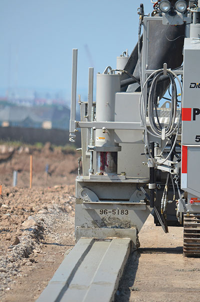
| The introduction of GPS technology has allowed companies like Dicrete to produce concrete curbs without running stringlines.
|
The 2013 construction season marks the first year that Dicrete has integrated the stringless curb and GPS technology into its work. The first big project Dicrete tried the system on was a 1,000-house development with TACC Construction in Oakville.
“Starting out with the GPS technology, it’s like we’re starting a new company again,” says DiGravino. “I was skeptical at first because I didn’t know how it was possible to produce such a quality product using this system of curbing.”
The Dicrete team, which includes 90 staff across the entire operation, became familiar with the technology before applying it to its first jobsite: a 900-unit housing development in Oakville’s north end. On open land that was covered in dirt and mired in 40-degree heat, the Dicrete team went to work for the first time using the new combination of the stringless curb machine and the GPS system; the team was looking for efficient results in spite of the high temperatures.
“The quality of the work is very, very good,” explains DiGravino. “We are finding that, because everything is so precise, we’re noticing that our volumes are up.”
That precision is improving the overall quality of the concrete work that the company is able to do for its customers. And while curbing isn’t the only part of the operation (it does sidewalk and concrete repair work as well) it is integral to maintaining and growing the business. Providing the most precise specification possible gives the company a competitive edge.
“It’s so close and such a tight margin that we’re actually getting the most bang for our buck.”
Topcon’s Millimeter GPS System
The Topcon system features multiple components that work together to provide accurate results on the job site:
- The PZL-1 sensor, which provides precision vertical information
- The GX-60 control box, which displays machine position on the job, the sensors being used to control the screen, current elevation and slope
- The MC-R3 control centre, which contains all of the GPS receivers, controllers and radios in a single unit
- The PZS-MC Positioning Zone laser receiver, positioned on the paver to receive information from the sensor
- The GR-5 receiver for acquiring satellite and radio signals
- Pocket 3D, which allows for remote tracking of data processed through the Millimeter GPS system
These elements combined make up the GPS system that has provided Dicrete with the desired results.
Print this page