
Products & Equipment
Heavy Equipment
John Deere collaborates with AGTEK
December 2, 2016 By John Deere
December 2, 2016 — As contractors increasingly use 3D digital models and GPS technology when grading a job site, John Deere is joining forces with AGTEK — one of the civil construction industry’s leading providers of takeoff and 3D modelling software — to increase efficiency and ease the takeoff and modelling process across job sites of all shapes and sizes. The data integration simplifies the process of utilizing 3D design files when grading, enabling John Deere dealers everywhere to support customers implementing grade-control software into machinery.
“Collaborating with AGTEK allows our dealers to work closely with their customers to support the whole grade control workflow process. This includes cut and fill maps, demo models and state-of-the-art 3D views of their project,” said BJ Bauman, instructor of John Deere WorkSight. “John Deere customers can simply contact their dealer to support the takeoff process, which allows the customer to be more competitive. File conversions are also easily formatted to support SmartGrade demos with existing Trimble or Leica users. The AGTEK solution aligns with our open architecture approach to grade control management as it’s capable of ingesting any 3D environment format.”
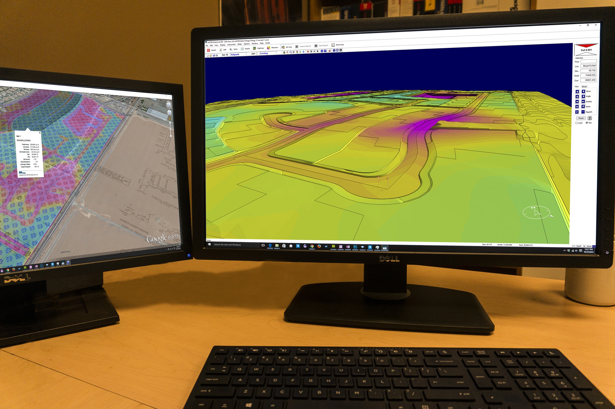
AGTEK’s takeoff and site modelling solution, Earthwork 4D, quantifies and provides unmatched field documentation across a wide variety of machinery. The technology isn’t only accessible on construction equipment. Earthwork 4D uses internet keys, which let customers work from their office, truck or kitchen table for an even greater value in this connected world, further enhancing the power of John Deere WorkSight™.
In addition, with John Deere and AGTEK working together, contractors can have a simplified process to plan everything, from moving dirt to estimating how much equipment is needed for a project. With AGTEK’s WorkSight integration, contractors everywhere can reduce equipment and labor costs with a streamlined grade-control process that requires less manpower and less machinery when tackling a job site. With added support from the John Deere network of dealers, contractors everywhere are capable of quickly adjusting 3D maps to keep construction projects moving forward, quickly.
“Every contractor is looking for a competitive edge, and utilizing AGTEK is an eye-opening experience for our customers. It’s empowering them to use the latest and greatest in technology to attack the job the best way possible and give them a full grasp of the GPS experience,” said Mike Burns, grade control specialist, JESCO Inc. “We believe in the future of GPS technology as it allows us to put our customers in the best position to succeed; and John Deere working with AGTEK does just that.”
To learn more, contact your local John Deere dealer.
About Deere & Company
Deere & Company (NYSE: DE) is a world leader in providing advanced products and services and is committed to the success of customers whose work is linked to the land – those who cultivate, harvest, transform, enrich and build upon the land to meet the world’s dramatically increasing need for food, fuel, shelter and infrastructure. Since 1837, John Deere has delivered innovative products of superior quality built on a tradition of integrity. For more information, visit John Deere at its worldwide website at www.JohnDeere.com.
About AGTEK
AGTEK Development Company Inc. (privately held since 1981) provides DIRT SIMPLE™ software solutions for takeoff, modeling and control of earthwork, paving and pipe, to contractors who estimate and perform civil construction. Visit AGTEK at www.agtek.com.
Print this page