
Features
Aggregates
Technology
A case for drones
One company recognizes the financial benefits of investing in drones
July 12, 2016 By Andrew Macklin
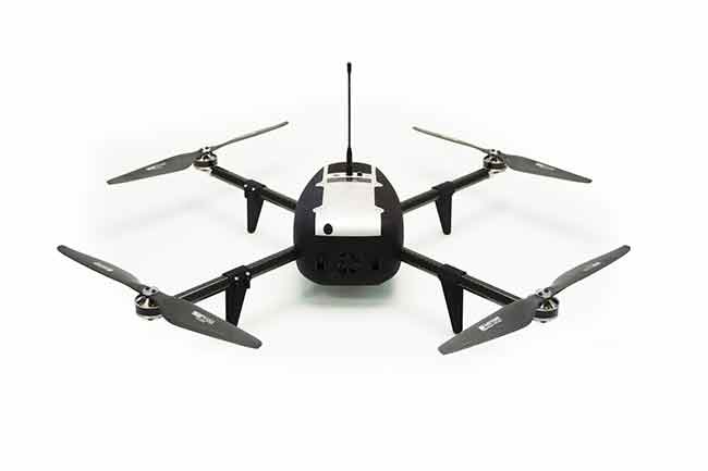
July 12, 2016 – It was just a few months ago that JF Gabanna, director of business development for Interoute Construction Ltd. (a subsidiary of Terus Construction), first got his hands on a drone. Sure, he had seen a local company makes its case for using the emerging technology, but it wasn’t anything that was completely on his radar.
That changed when management at Terus Construction informed staff that the new tool would be incorporated into the operation.
“Our sister operations in Alberta were using drones before our B.C. operations,” Gabanna says from his office in Crescent Valley, a small community nestled in the Kootenays in southeast B.C.
Understanding the technology
Over the past few months, Gabanna and his team have been doing some training with their colleagues in Alberta in order to gain a greater appreciation for how the technology works, and how it can benefit the operation.
For starters, an entire site can be surveyed in, at most, 30 minutes from start to finish. That covers each pit/quarry, most of which have 6-12 stockpiles. That is a significant reduction over the hours it can take to manually check each stockpile throughout the site.
“We have a lot of gravel pits and gravel stockpiles,” Gabanna says. “The idea is for us to be able to manage our inventories and have stockpile surveys done a lot quicker.”
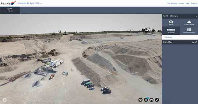
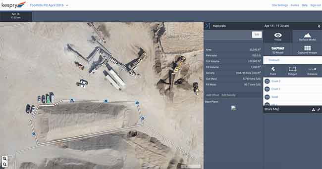
Once the drone has captured the site visuals, the operator is able to go on to the Kespry site to access their data (Kespry hosts the data for you as part of the cost of the drone). Once the site visual has been loaded, a polygon tool is used to outline the rough limits of the pile. The operator sets the elevation points around the pile to tell the program what level is ground and, within seconds, you are able to find out the volume of the pile. Also, there is an option to input density to gain a weight measure of the pile as well. At the end of the day, you end up with accurate readings in metric units to provide a comprehensive understanding of exactly how much material is in the stockpile.
In addition to the benefit the drone provides in stockpile management, it also provides the ability to provide detailed information on the contours of the site, providing the site manager with the information for proper site planning.

Improved safety
There are also serious safety considerations to factor in with the use of drones for stockpile management. First of all, the operator can set up and launch the drone from the periphery of the operation, far removed from the machine operations and materials movement throughout the bulk of the pit or quarry. Secondly, there is no more need for the surveyor to work their way onto the stockpile with equipment in tow, eliminating the risk of injury that can occur from falling down while trying to climb up the aggregate stockpile.
“Getting a machine to flyover top of the piles, versus having one of our guys walk all of the piles is far less hazardous for our staff,” says Gabanna.
And from the early trials, there is no question of accuracy.
“Our experience in Alberta has been that the stockpile reports are consistently accurate with what we had in the past,” Gabanna says. “Our numbers are pretty much identical between surveys and test flights.”
Looking forward
Terus will incorporate three drone kits into its B.C. operations, one for each of the primary regions that the company works in (northwest, northeast and southeast).
With drone use becoming a cost-effective stockpile management for quarries and pits, and helping to also eliminate a major safety issue, it’s only a matter of time before more companies make drones an integral piece of equipment for their day-to-day operations.
Print this page